The founder from Erin goes live on GIS Day with a super cool community map built around time, and he's joining the Catalyst Commons Vertex accelerator.
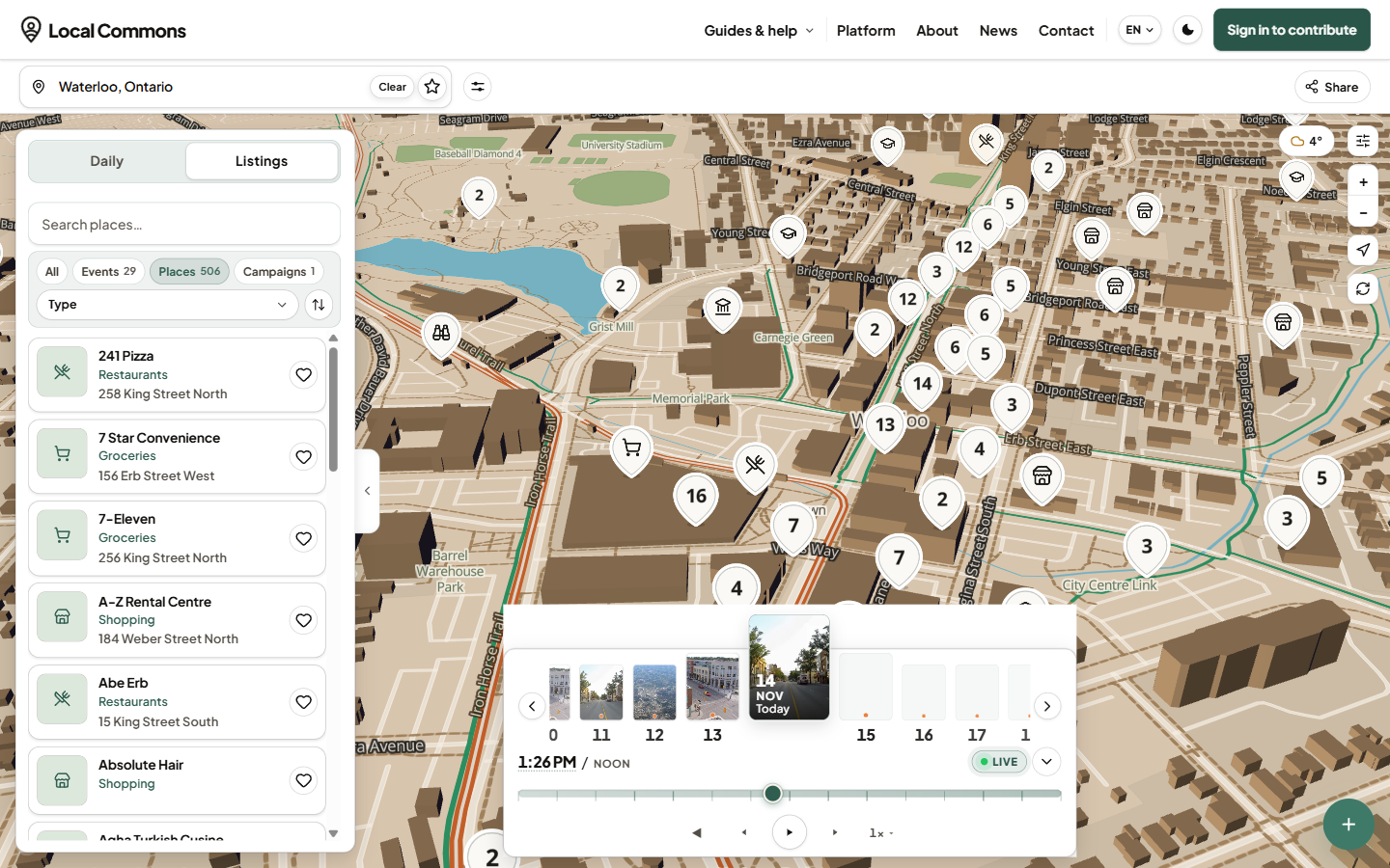
Local Commons showing Waterloo
I first met Tom Pischel at an Accelerator Centre event in September, where he showed me a map of Waterloo with the day's events popping up and disappearing again once they ended. I thought it was so cool! When I ran into him again last week, he told me he was launching it properly on GIS Day, the day map people around the world show off what they've made, so I hopped on a call with him yesterday.
Today is the big day. Local Commons is now live, and Tom also let me share some awesome news first, which is that he's joining the Vertex accelerator at Catalyst Commons in Waterloo. Huge congrats Tom!
2017
Tom starts Dwellcome, a digital welcome wagon for people moving into a neighbourhood
2024
AltGrocery goes up during the grocery boycotts
Oct 2025
LocalXP starts
Apr 2026
LocalXP launches at the conference for Ontario's BIAs
Sep 2026
AltGrocery becomes the first layer on Local Commons
Nov 18, 2026
Local Commons goes live on GIS Day
It started with a grocery map
Tom's first map was AltGrocery, which he built in 2024 during the grocery boycotts so people could share the small shops and farmers' markets near them. "They have community pride," he told me, and that stuck with him.
After he moved from Oakville to Erin, he built LocalXP to help small town businesses get noticed. Over 30 BIAs were interested, but none of them had time to set up their whole town. "I'll do the work," Tom said, so now he sets up each town himself, and that's Local Commons. I thought that was really cool.
A map built around time
In a small town, Tom kept seeing the same questions in the local Facebook group. "What's the roads like? What's the weather like? Where do I find this local place? What day is garbage day?" he told me. So he pulled it all into one map, with roads from Ontario's 511 service, open weather data, events from town websites, and places from OpenStreetMap that locals can earn points for fixing. The part I love most is the slider, which lets you drag through the day and watch places open and close.
“
Location is basically a constant. But what people don't always think about is there's still time involved.
Tom Pischel
His favourite example is the Witches Walk in Erin this October. When the event started, the map switched over to show only the event, with its vendors, its agenda and even the detour for cars, and when it ended the stores came back on their regular hours without anyone pressing a button. Every town has its own timeline, so you can still go back to October 23 in the Town of Erin, click the event card, and see it for yourself.
There's also Signals, where anyone can drop a pin for 24 hours about a fallen branch, a missing dog or a lemonade stand, and a QR code for everyone so an event can count people at the gate. Tom's thinking is that a Main Street event asking for funding could finally show real numbers, which I think is a really smart use for it.
Toronto on Local Commons, with the GO train lines Tom modelled in 3D
Tom told me the 3D TTC and GO lines in Toronto are his own work, and so are the neighbourhood boundaries. He drew every neighbourhood in Canada mostly by hand back in his Dwellcome days, with Google Maps on one monitor and his drawing program on the other. I couldn't believe that one. That's a huge amount of work!
Why Waterloo
I was curious why someone in Erin keeps showing up at events here, so I asked. Tom told me he was part of Communitech when he first started, that Toronto is too far for him now, and that Waterloo is where the tech is.
“
Now that I'm going to be part of the Catalyst Commons Vertex Accelerator, there's another opportunity there. So for me, it's the networking and opportunities.
Tom Pischel
CCIN is the Catalyst Connected Infrastructure Network at Catalyst Commons, which OVIN named in May to run the Region's mobility test site, with more than 500 smart intersections and 1,200 connected city vehicles. That sounds like a perfect fit for someone already pulling in road data.
Not a programmer, and building it all himself
Tom isn't a programmer by trade. He wanted to be a video game modeler, so he moved out to Vancouver to study 3D animation, and then worked in animation for film and TV for years. After that he tried a bit of everything, from sound and video design to photo retouching, illustration and UI design, and he freelanced for years. He even paid for his first startup by freelancing on the side.
“
I was doing other people's startup work for my own startup, basically.
Tom Pischel
Later he ran his own design agency, Pixel Mixel, and he told me he was always one of those "WYSIWYG type of developers," building sites in Webflow and WordPress.
AI changed that for him. For Dwellcome, his first startup, he had to pay a development company to build it, and now he builds everything himself. His 3D background helps a lot here too. Tom told me building a 3D map came naturally to him, and knowing the right terms makes it easier to direct AI when it builds 3D assets. He told me most of LocalXP was built with Claude, and he admitted he built way too much at first. "I wasted too many credits just to build stupid things that I thought would be cool," he told me, and I told him I've done the exact same thing.
What's next
Tom reminded me a lot of Mike Nickason, who I wrote about last week. Neither started out as a programmer, both now run their own companies with AI, and Tom told me they'll be in the same Vertex cohort too. Tom is bootstrapping for now, and he's starting the new year with a pilot in Brussels, Ontario.
Thanks so much for the chat Tom, and good luck with the launch! I'd love to hear what you all think of it, so send me a note.